Wednesday, March 29, 2017

Glenbow Ranch Provincial Park

Trip Date: March 2017


Glenbow Ranch Provincial Park
Take a step back in time and discover some of Alberta's earliest frontiersmen at Glenbow Ranch Provincial Park. The Canadian Pacific Railway (CPR), in their ambitious quest to span the continent, continued their westward push reaching Cochrane in the fall of 1883, opening more of the Canadian west for settlement, ranching, and industry. Due to the fact all trains at that time were steam powered, water was a necessary component for operation. In 1889 the Glenbow Valley immediately east of Cochrane was selected for a water tank and a section house. This land originally belonged to the Cochrane Ranche, one of the most ambitious cattle ranching experiments of the late 1800's. By 1903 the CPR had established a station and laid additional track that ran parallel to the mainline, known as siding. Then in 1905 the small, but growing community of Glenbow became a flagstop along the CPR's mainline. This decision provided much-needed passenger and freight services that were sorely lacking for the valley's residents.

If you look to the east as you enter the parking lot you can see the ruins of the Stevenson home on Millionaire Hill
Looking west towards the Rockies from the viewpoint near the parking lot
Looking east down the valley with the Bow River far below
All that remains of the Morris family home are two chimneys; one brick (above) and one stone (below)
The Morris family lived on Millionaire Hill from 1914 to 1918. The home eventually burned down in 1977, leaving behind only these two chimneys.
The railway was directly responsible for the birth of Glenbow. As early as 1907 men were mining the valuable sandstone in the hills above the town. The sandstone was a sought-after building material. Were it not for the railroad the Glenbow Quarry would not have had access to a market to sell its product and without the quarry the town of Glenbow likely wouldn't have been needed. As the quarry flourished, so too did the burgeoning town. Corrals, a grain elevator, a stock chute, a post office, a general store, and a school were all built to suit the town's growing needs. Wealthy businessmen and their families flocked to the valley, erecting elaborate homes on the hillsides overlooking the town below, which eventually earned the nickname 'Millionaire Hill'.
"We have many visitors at present who are anxious to buy lots for residential purposes, being so close to Calgary, and where the best fishing and sport can be secured easily." 
                               ~Calgary Daily Herald, April 7, 1909
This is the only building still standing from the once thriving town of Glenbow. This is the General Store & Post Office and was originally painted green. Both businesses closed in 1920.
These piles of unused bricks are all the remain from the failed Glenbow Brick Plant
These corrals were built in the 1950's and were upgraded in the 1960's by Glenbow Ranching Ltd.
The Glenbow General Store & Post Office with a backdrop of the Canadian Rockies
Richardson's Ground Squirrels can be seen by the dozen in the park
By all accounts Glenbow was a roaring success. At the height of its prosperity 350 residents called the town home, but alas this success story was to be short-lived. The sandstone, the root of Glenbow's achievements, was discovered to be flawed. Due to present weaknesses to freeze/thaw erosion the sandstone could only be used for the lower sections of buildings and the deeper parts of the stone contained a 'blue hardhead' that was very difficult to work with. Due to these limitations and the frequent break-downs in the quarry's expensive equipment the whole operation closed in 1912, leaving the future of Glenbow quite murky.
"The town of Glenbow situated as it is in the hollow surrounding hills and on the banks of the river Bow, is destined to become a large town, if not a city, in the course of a very few years."                                
                               ~Calgary Daily Herald, July 15, 1909
Crossing the railroad tracks
A section of the Glenbow Trail that eventually ends up in Calgary
Hiking along the Bowbend Trail with the Park Office at the top of the hill in the background
This stone chimney is the lone testament to the historic Waverley Ranch 
In an effort to combat the quarry's closure a brickyard was established, but it too was shuttered in 1914 due to mounting debt and poor quality product. That year also marked the beginning of World War I and many locals left to join the war effort or to pursue other interests in different locales. The population slowly declined over the years until the last residents moved away in 1927, leaving only industrial relics, a few crumbling foundations, and the long-abandoned general store.

Look at the ears on this Mule Deer that I spotted across the coulee from the Tiger Lily Trail
Hiking the Tiger Lily Trail
Just off the trail are the rusting frames of several cars from days gone by
There is no interpretive sign about these automobiles, so I can only guess how they ended up on the side of this hill
This vehicle is almost completely overgrown
Glenbow remained a private ranch owned by the Harvie family until 2006 when the land was donated to the Government of Alberta and would officially become Glenbow Ranch Provincial Park in 2008. After a $3 million face-lift, which included pathways, viewpoints, fencing, maps, interpretive signs, a railway crossing, washrooms, and picnic facilities, the park officially opened in summer 2011.

As I was leaving the park I saw this Red-Tailed Hawk soaring in circles while utilizing a thermal updraft
The hawk was carrying some nest material in its talons
The park features more than 25 kilometres of paved and un-paved trails to suit all ability levels. My day consisted of hiking along the Glenbow, Bowbend, and Tiger Lily Trails, which passed many of the park's historical artifacts. I totaled about 12 kilometres over the course of the afternoon, but would love to get back there again sometime soon and see what the rest of the park has to offer.

Tuesday, March 28, 2017

Big Hill Springs Provincial Park

Trip Date: March 2017


Big Hill Springs Provincial Park is an isolated pocket of green in the rolling hills north of Calgary. It's located in the parkland natural region of the province and is only 40km northwest of downtown. The park gets its name from the underground springs that feed streams and small waterfalls throughout the year. The park, although small, is very popular with families, making it quite busy during the summer months. There is a short hiking trail (less than 2.5km with under 50m gained in elevation) that weaves through the park, crossing streams and passing the picturesque waterfalls.

Big Hills Springs Provincial Park
I ventured to the park for the first time just recently and had the pleasure of enjoying the scenery and discovering its varied history. There were several families there, but it wasn't overcrowded and I saw very few people while on the trail. There is a kiosk that greets visitors in the parking lot and tells the story of the unique geological formations, known as tufa (pronounced too-fah), that can be found throughout the park. The interpretive sign reads...
The most interesting geological features in this park are the mounds of unusual rocks called tufa. Tufa is a rock that forms when calcium and carbonate-rich water emerges from the ground. As the water comes to the surface, it releases carbon dioxide into the air and forms calcium carbonate rock we call tufa. These tufa mounds have been forming for thousands of years and are still forming today. Here you can see geology in the making. The evaporated water often leaves behind impurities, such as rust, that give tufa its yellow and red colouration.
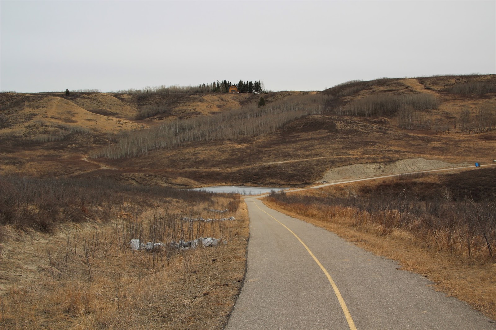
The open valley as viewed from the parking lot
The springs also date back to pre-contact times when First Nation people moved about the landscape. The sandstone cliffs that surround the park are part of the Paskapoo Formation and were used as a buffalo jump. The close proximity of fresh water provided by the springs made the coulee a highly prized area for hunting and camping.

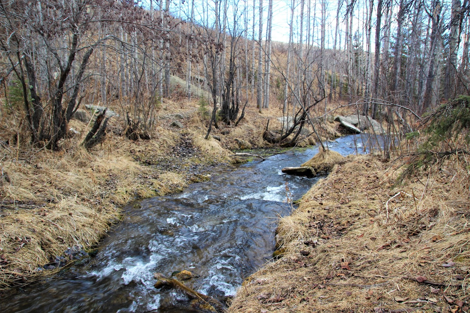
The stream as it flows near the parking lot
One of the first small waterfalls
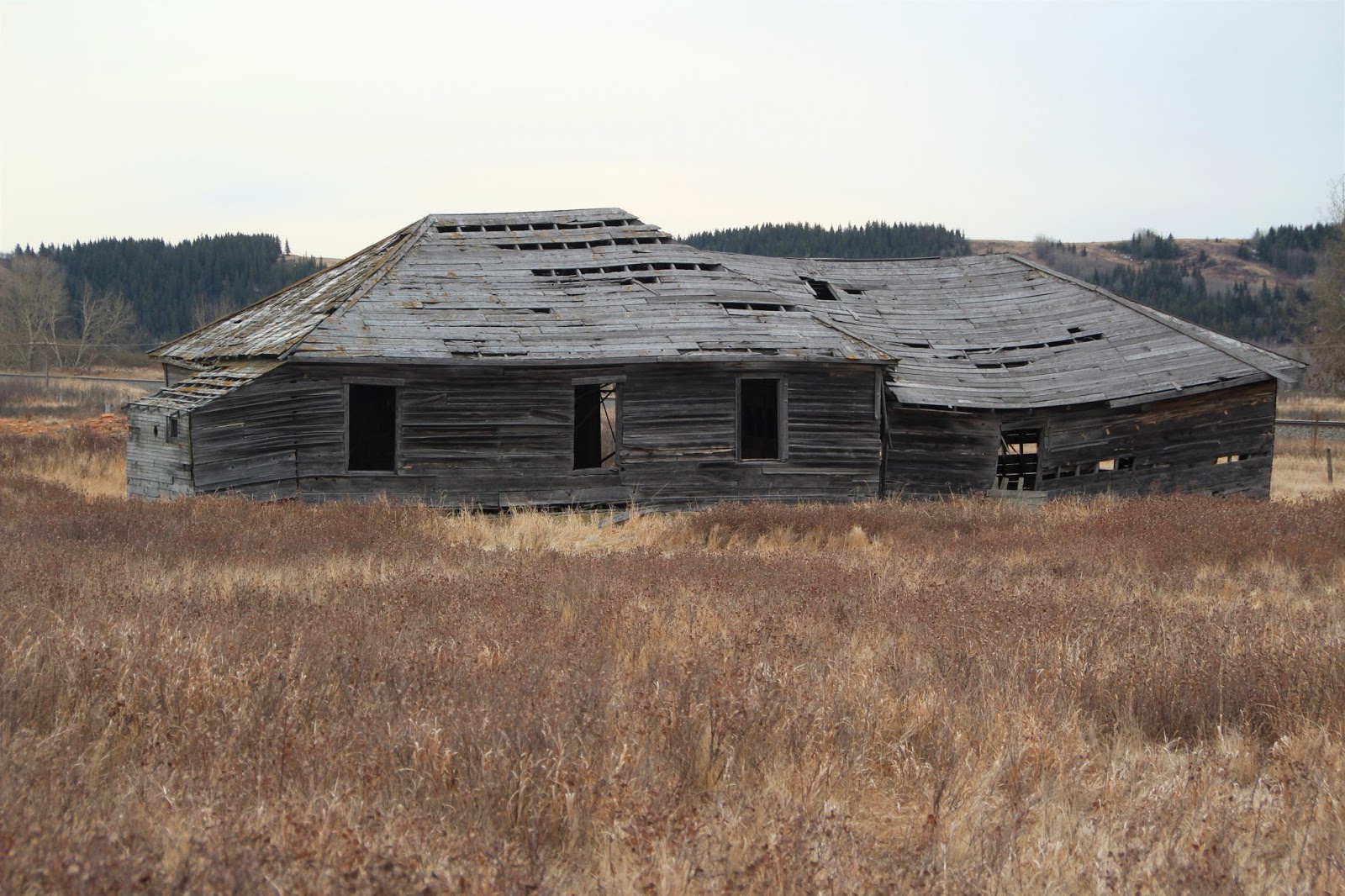
The springs also powered the machinery for Alberta's first commercial creamery that was built by D.M. Radcliff back in 1891. It is believed the creamery supplied the North West Mounted Police, railway construction crews, and the young City of Calgary.

The deteriorating concrete structures you see in this photo are all the remain from the failed fish hatchery
The stream flowing around the concrete ruins
A large mound of tufa
More recently an experiment was conducted to see if the springs could be used to mature fish eggs. 
In 1951, fisheries employee Cecil Barnhardt lived at the site, in an experiment to see if fish eggs could be matured there over the winter months. Barnhardt had to contend with loneliness, blizzards, snow-blocked roads that prevented getting the necessary coal, silt in the water that constantly threatened the fragile eggs, a fire that nearly burned down the hatchery, and even an owl that tried to carry off his dog. In the end the hatchery never succeeded and the project was abandoned.
More cascading waterfalls
Flowing stream and waterfalls over tufa formations
An unofficial trail up a steep embankment leads to this view of the park
A late March hiking adventure may have been a bit too optimistic. Large sections of the trail were still covered in snow and ice and those that weren't were very muddy. For future reference waiting until the ground has had time to dry might be a better option.

Just one of the stream crossings
Some believe this rocky wall is the remains of an old beaver dam that became encased in tufa. It is more likely, however, that the 'dam' formed naturally when the stream became blocked by the growing tufa.
Here the stream flows around the aforementioned dam
Due to its popularity and the curious nature of its visitors the park has numerous unofficial trails, which can make it difficult to navigate. More than I once found my progress blocked by a stream or a fence-line that indicated the park's boundary. Use the small signs that are affixed to trees to assist you on your journey.

These small signs will come in handy as you trek through the park
Someone built an impressive teepee out of deadfall that overlooks the valley below
The park borders private land so it's important to obey these signs and not venture past them
I was pleasantly surprised with Big Hill Springs Provincial Park. Due to its popularity with families I'm surprised it doesn't get more attention, but maybe its famous mountain cousins command the majority of the spotlight! If you're looking for something a little different that's close to home I would suggest giving this park a try. I know these photos are kind of drab, but that's to be expected this early in the spring. I can only imagine how beautiful this area will be in the middle of summer.

Monday, March 20, 2017

Mount Norquay

Trip Date: March 2017


It's not everyday that I get to write about a ski/snowboard resort, but I recently had the pleasure of visiting Mount Norquay for the first time and keeping with tradition (see Delirium Dive as my most recent snowboarding post) I will share a blog post about the hill. I tend not to write every time I go snowboarding as it would be pretty monotonous and boring, but whenever I get to visit a hill for the first time I like to share my experience on this blog.

Mount Norquay Trail Map
Mount Norquay is located in Banff National Park and is considered one of the Big 3 resorts along with Sunshine Village and Lake Louise, although Norquay is considerably smaller than the other two. It has 60 runs spread over 190 acres of terrain. The earliest ski runs date back to 1926 and the original lodge opened in 1929. Mount Norquay is only 10 minutes from downtown Banff and is approximately 130km from Calgary. We ended up at Norquay to support the Canadian Cowboy Ski Race, which is a major fundraiser for the Canadian Pro Rodeo Sport Medicine Team, the founders of which are Christine's co-workers.

The summit of Mount Norquay is shrouded in clouds, but you can see the race course for the Cowboy Ski Race
Even though they had 4cm overnight the warm temperature made the consistency of the snow something like wet cement. On top of that it rained on and off throughout the day, so we were completely soaked before lunch time. That didn't stop us from enjoying ourselves and exploring what the hill had to offer.

Those lifties think they're so funny!
About to drop in on a run
Although not politically correct the tree-covered mountain is Stoney Squaw and it sits between Mount Norquay and Cascade Mountain
You can see the Banff town site in the background and that little hump is actually Tunnel Mountain
A quick GoPro selfie on one of the runs
Jeff, Sarah, and I riding the lift
Although Mount Norquay is not my first choice when it comes to ski and snowboard resorts I can see the draw for families as it's smaller and quieter than its larger neighbours. Due to the unfavourable conditions I would like to come back and see what it's like when the snow is good.