Monday, September 28, 2015

Sundance Canyon

Trip Date: September 2015


Sundance Canyon is a popular multi-use trail in Banff National Park.  It offers great scenery of the surrounding mountains along the Bow River and eventually veers away from the river becoming a forest-covered stroll through the woods.  The one caveat I would place on this trail is that the majority of it is paved, making it more accessible than most trails in the park (ie: strollers, wheelchairs etc.).  The trail begins at the Cave & Basin National Historic Site on the southwest corner of town.  From the parking lot to the end of the pavement is 4.3km with another 1.2km loop through the canyon.  You will gain approximately 145m in elevation.  The canyon section is not paved and the trail becomes much steeper than the gentle grade offered on the pavement.

Christine and I had never done this trail before, but we wanted to see what it was all about so we tackled it on a Sunday morning before heading back to Calgary in the afternoon.  We were also scouting the trail as an option for Christine's parents who would be spending a long weekend in the Banff area in October and wanted to do some hiking while there.

A typical section of the Sundance Trail
Beautiful fall colours along the Bow River
Entering Sundance Canyon
Fall Colours
Sundance Creek flowing through the Canyon.  You can see how much elevation is gained once you're off the paved trail.
There was a large bird's nest perched on the canyon wall.  There weren't any birds present so I'm unsure what species built it.
Looking back down the canyon from the bridge
Sundance Creek
The trail through the canyon
It's a bit hard to see, but that's Christine standing on the bridge below me.

Saturday, September 26, 2015

Goat Creek Trail

Trip Date: September 2015


Goat Creek is a popular multi-use trail that's located in both Spray Valley Provincial Park and Banff National Park.  It runs on the west side of Mount Rundle between the towns of Canmore and Banff; crossing both Goat Creek and the Spray River.  The trail is 19.3km in length and is best done from east to west as the majority of the trail is flat or downhill in that direction.  Christine, Sarah, Jeff, and I decided to ride Goat Creek Trail in late September.  This marked the second time that Chris and I have used the trail, but would be Sarah and Jeff's first.  Although riders can use the Rundle Riverside Trail or the Banff Legacy Trail to return to Canmore we opted to leave a vehicle at the Bow Falls parking lot and only ride one direction.

Goat Creek Trailhead
Beautiful fall colours as we start the ride
That's Ha Ling Peak in the background
Sarah, Christine, and Jeff on the trail
The girls
Crossing Goat Creek with Mount Rundle in the background
The girls enjoying the ride so far
Crossing the Spray River
Bike selfie
Near the end of the trail we passed this tree that was covered in claw marks, likely from a Black Bear
Another great day outside!
We had a great afternoon ride and capped things off accordingly with a couple of pints and some food at Wild Bill's Legendary Saloon in downtown Banff before heading back to Canmore for some relaxation in the hot tub!

Thursday, September 24, 2015

Enter The Rat's Nest!

Trip Date: September 2015


I found myself in a precarious position. Lying on my stomach, face in the dirt, sandwiched between limestone on all sides. Swallowed in darkness, except for the beam of light projecting from my headlamp. Moments before I had been reassured that I would fit through this narrow opening in solid rock, but now feeling the squeeze my mind started having serious second thoughts. What if I am truly stuck? What happens if my headlamp runs out of batteries? Is something living down here? I can't reach my snacks! I could barely hear the muffled voices on the other side of the rock wall. What were they saying? Were they formulating a plan to dislodge me or were they just laughing at my boots, desperately flailing in an attempt to gain traction? Maybe I'd never know. I can't believe I got myself into this…

The entrance to Rat's Nest Cave
Christine and I about to start our adventure
If you're anything like me you venture west to the mountains on a regular basis. You might hike, camp, bike, ski, paddle, or some combination thereof. Not that any of those aforementioned activities ever get boring, but sometimes it's nice to try something different. Something out of the ordinary. Something to push you outside your comfort zone. Enter Canmore Cave Tours; a company that provides guided outings to Rat's Nest Cave. The cave, one of the longest in Canada, is located below Grotto Mountain; the limestone monolith that sits east of Canmore. The mountain is likely better known for the popular hiking trail through Grotto Canyon than it is for its subterranean cave. The cave is currently ranked the 13th longest (4,005 metres) and 18th deepest (245 metres) in Canada.

Christine making her way up to the entrance
Canmore Caves Tours was started by Dr. Charles "Chas" Yonge back in 1985 and was the owner and operator for 25 years before selling to Adam Walker, the company's current owner. Rat's Nest Cave was first "discovered" in 1972, but there is ample evidence to suggest human presence as far back as 3,000 years. The exterior entrance was once adorned with pictographs, now indistinguishably faded. There is also a solitary figure depicted on the interior ceiling; a Medicine Man. Although almost indecipherable it's believed this painting is related to the more famous pictographs in Grotto Canyon, as well as the Medicine Man that's portrayed near Grassi Lakes. The cave was first opened to guided expeditions in 1992 and Canmore Cave Tours has been going strong ever since; guiding up to 5,000 people through the cave each year.

The faded pictograph of a Medicine Man
The same photo as above, but this one has been processed using DStretch
You can read more about the pictograph and petroglyph sites I have visited by visiting my Western Canadian Rock Art section on the Bradshaw Foundation's webpage.

Rat’s Nest Cave, far from a romantic name, acquired its title from the Bushy-Tailed Woodrat, also known as a Packrat. When discovered, the cave’s entrance was filled with Packrat nests, concealing most of the tunnels and passageways. Once removed, the rest of the cave slowly revealed itself to early explorers. The tunnels and caverns were formed as glacial meltwater seeped through fractures and faults in the rock layers, slowly eroding the limestone and eventually creating the cave we have today. Rat’s Nest Cave is considered a wild cave, meaning it doesn’t feature paved walkways, overhead lighting, or handrails. It exists very much as it did when it was first discovered.

The start of the rappel
Crawling through the Warm-Up Squeeze
Christine exiting the Warm-Up Squeeze
Safety is an important part of any adventure and caving is no exception. Caves are inherently dangerous places with slippery surfaces, narrow channels, uneven surfaces, and pure darkness. Our Senior Guide Chris, who was absolutely phenomenal, placed a high degree of importance on safety throughout the tour. Each group member was briefed on the gear and reminded about the dangers of the sport. The Alberta Cave Rescue Organization certifies all guides in Cave Rescue and each guide also holds certification in Wilderness First Aid.

Headed down the Laundry Chute
Slowly making progress
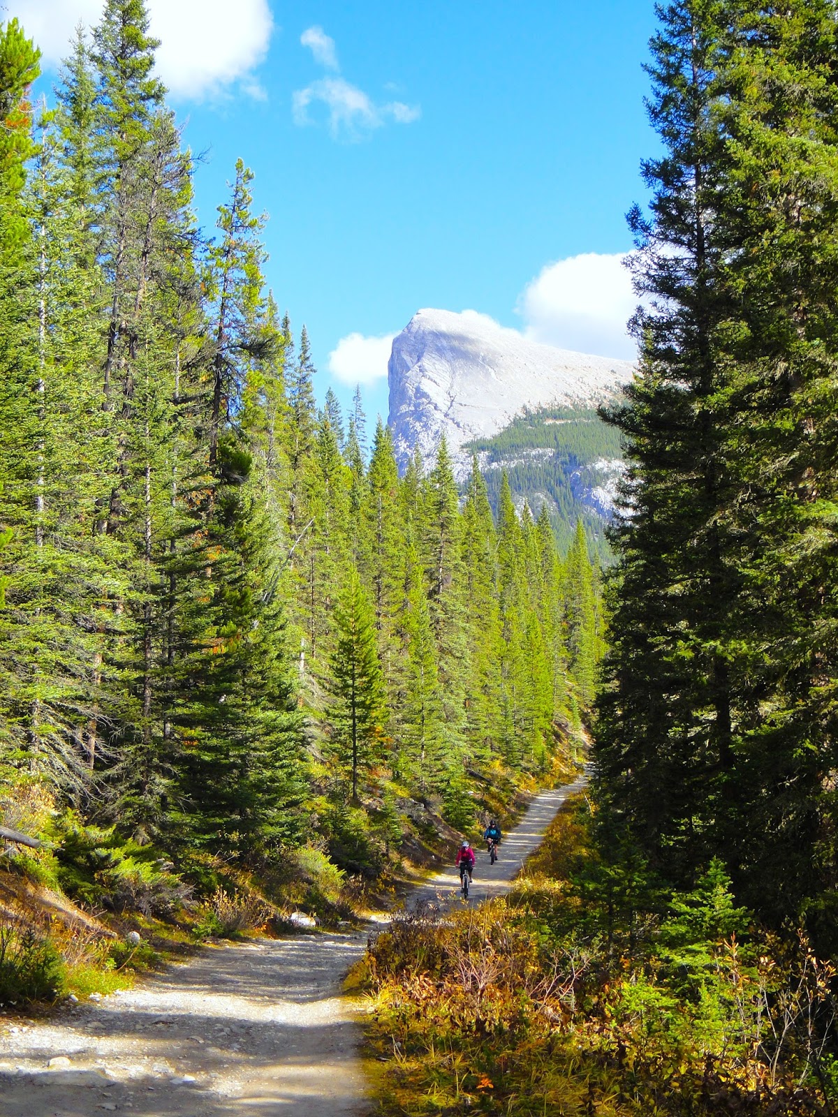
A short thirty-minute hike is required to reach the mouth of the cave. To protect the cave’s fragile environment the cave and a square-mile surrounding the entrance were designated a Provincial Historic Resource in 1987. The entrance is guarded by a large metal gate with openings big enough for wildlife (such as Packrats, bats, and shrews) to enter and exit, but too small for humans...unless you have the key! The cave sits on private land and access is controlled by Canmore Cave Tours in conjunction with the landowner. You need to be accompanied by a guide or granted permission to explore the cave on your own. Due to this careful management the cave remains largely in pristine condition, which is a major highlight for all who visit.

Calcite deposits inside the cave
Soda Straws on the ceiling of the Grotto
There's a pond in the Grotto that's been explored by cave divers!
More calcite deposits inside the Grotto
Once inside the real fun begins. The ambient temperature hovers around 4 degrees Celcius, so layering is important, but guests are kept fairly active throughout the experience so as not to get chilly. We opted for the Adventure Tour, the company’s flagship program, which has been recognized as a Canadian Signature Experience. This tour will keep you underground for about four hours and features an eighteen-metre rappel, three squeezes (Warm-Up, Challenge, and the Laundry Chute), as well as visits to the Grotto and Grand Gallery, the largest known room in this cave system. Throughout the day we were treated to facts and stories about the cave’s history, formation, inhabitants, geology, and shown examples of cave growth such as stalactites, stalagmites, soda straws, and more. As we first entered the cave we were able to peek over the ledge of a 15-metre chasm, affectionately referred to as the Bone Pit. At the bottom of this deep hole is a 2-metre deep pile of bones, containing the remains of at least 34 different species of wildlife, including bear, sheep, bison, elk, deer, fox, coyote, various birds, and even fish. Some were the result of unfortunate accidents, such as falling into the pit, while others arrived from above during times of flood and were washed into the cave. Others yet may have been the meal of our distant ancestors who, once finished, tossed their scraps into the pit; much like an ancient garburator.

A collection of bones from the Bone Pit. Small rodents will collect bones from the pit and chew on them to obtain minerals, such as calcium. When they’re done they’ll randomly discard the bones throughout the cave. 
The cave tour is the perfect adventure for anyone looking to try something different or step outside his or her comfort zone. Although I likely wouldn’t recommend this type of activity to someone who suffers from claustrophobia, please note that many of the tight spaces are optional and there’s always a way around in case something pushes you too far. They definitely operate under the challenge by choice method, meaning if you’re not comfortable you can choose to forego it.

Posing with calcite build-up. These stalagmite (right right) and stalactite formations could eventually join, creating a column of calcite (near right), but this process can take hundreds of years.
…as my mind races from one dreadful scenario to the next, I realize that I’m not actually stuck. Having felt the rock between my shoulder blades my brain went into survival mode. As my toes regained purchase on the ground I was able to wriggle myself free and slide out into an empty cavern on the other side. With beads of sweat running down my face (it’s not called the Warm-Up Squeeze for nothing) I smile sheepishly to myself, knowing full well I was never in any real danger. The mind can play tricks on you when it perceives a threat, even if that threat is manufactured internally. After all, stepping outside your comfort zone and pushing yourself further than you originally thought possible is all part of the experience. Realizing the openings were much larger than they appeared (and recognizing that Chris wouldn’t lie to me) made the rest of the tour much easier…including crawling back out of that original cavern unscathed. If it's a challenge you're after or want an adventure unlike any other, look no further than Rat's Nest Cave. You won't be disappointed!

We Survived!
This story was also featured on the Calgary Guardian website under the same name; Enter The Rat's Nest!

Wednesday, September 23, 2015

Chester Lake

Trip Date: September 2015


Chester Lake is a popular multi-use trail in Peter Lougheed Provincial Park, which is part of the Kananaskis Country system of parks.  The trailhead is located along the Smith Dorrien/Spray Lakes Road, approximately 145km southwest of Calgary.  The Chester Lake Trail is 9.2km round-trip with 300 metres gained in elevation, most of which occurs at the beginning.

As previously mentioned this is a very popular trail and this day was no exception.  The parking lot was almost full when we arrived and we continuously passed by other hikers throughout the day.  It's easy to see why this trail is so popular.  It offers incredible mountain views with a very picturesque lake and the effort required to reach them is quite minimal.  Even though the trail was busy and the threat of rain was always present, the fantastic scenery and wonderful company more than made up for it.

Mount Galatea as viewed from the trail
Mount Chester with a light dusting of snow
Tough to beat this scenery!
The clear water of Chester Lake
The lake sits below Mount Chester
There was a small waterfall at the far end of the lake
Reflections on the lake
 As we were driving back to Calgary we spotted this mother Moose and her calf.  They were very tolerant of us snapping a few photos and then the calf ran over to suckle from it's mother.  This was the most aggressive display of feeding I think I've ever seen!  The photo below doesn't even come close to doing it justice.

Mama Moose
Moose Calf
The calf suckling from its mom
Goofy Moose!

Thursday, September 17, 2015

Searching for Wild Bill

Trip Date: August 2015


I headed downslope to where the cubs were feeding and came up at them, hoping to scare them into one or another of my mining shafts for protection. It worked perfectly, as they ran for the nearest dark hole, and I went in with my ropes on the ready to see if I could catch one. I could hear the little fellows squealing in the dark and I paused a moment to let my eyes adjust. Just then I heard a tremendous roar and knew the sow was coming on the run looking for her wayward offspring. It didn't take her a moment to pick up the scent and she headed straight for the mouth of the shaft bent on destruction....

Entry from Bill Peyto's Mountain Journal "Ain't It Hell" - May 15, 1910

Anyone that’s ever been to Banff National Park has encountered Bill Peyto, even if they weren't aware of it. His likeness adorns the “Welcome to Banff” signs that greet visitors as they enter town. The raucous saloon on the corner of Banff Ave. and Caribou Street borrowed his famous moniker for their name; Wild Bill’sBill Peyto’s Café, a restaurant in Lake Louise that’s quickly becoming a favourite among locals, also bears his title. He even has a lake, a glacier, a mountain, and an Alpine Club of Canada hut all named in his honour. The man has reached legendary status in the wilds of Alberta.


Welcome to Banff National Park
Ebenezer William “Bill” Peyto was born in England in 1869 and immigrated to Canada in 1887 at the young age of 18. He eventually made his way to the Rocky Mountains of Alberta where he proved to be a proficient outfitter and mountaineer. Between enlistments in the Boer War and World War I, Peyto joined the Warden Service, making him one of the first wardens in Banff, which was known as Rocky Mountains National Park at that time. He married Emily Wood in 1902 and the birth of their son Robert soon followed. Emily suddenly passed away in 1906 and Robert was sent to live with his mother’s family for a time. Peyto remained with the Warden Service until his retirement in 1934. After retiring he lead a very private life until his death in 1943.


A portrait of Bill Peyto.  Photo from the Whyte Museum.
The stories about his exploits, embellished or not, are sure to lure even the most indifferent bystander into the mystique that is Bill Peyto. There’s the one where he walked into a Banff bar with a live Lynx strapped to his back, sending the patrons running for the exits, giving Peyto the place to himself. Or the winter he raised two orphaned Cougar kittens in one of his secluded cabins so they wouldn’t perish. Or how he would regularly leave clients alone for the night during outfitting expeditions so he could have some solitude. It was his need for privacy and seclusion that drove him deeper into the wilderness where he could coexist with the natural world instead of the manmade one that was rapidly developing around him. Peyto erected several cabins in the Healy Creek area of Banff National Park where he could be alone and maintain his other interests such as trapping, prospecting, and mining.

The front cover of Ain't It Hell, Bill Peyto's Mountain Journal
Several years ago I learned at least one of Peyto’s cabins was still standing; hidden away from the public as Peyto himself had intended. I’m not referencing his fully restored cabin that sits on the grounds of the Whyte Museum, but a cabin that remains exactly as it was when Peyto left it for the final time. I immediately started researching, hoping to uncover the location, but like surviving a harsh winter in the Canadian backcountry, finding the cabin proved exceedingly difficult. Google searches only revealed veiled references to the cabin’s existence; nothing concrete in terms of an actual location. Discouraged, but not defeated, I turned to word of mouth tactics and began talking with folks that knew about the cabin and some who had even been there. Despite my best efforts I was only able to uncover the fact that the cabin truly does exist and that it was in the vicinity of Simpson Pass. It appeared that the cabin's location was a closely guarded secret and without specific details searching that vast forested area would be the equivalent of looking for the proverbial needle in a haystack. I didn’t give up entirely of standing in Peyto's forgotten cabin, but my hopes were diminishing rapidly.


Peyto kept his packsaddles and outfitting gear in this cabin when he was guiding.  The cabin, originally closer to the Bow River, now sits on the grounds of the Whyte Museum and is one of Banff's Heritage Homes.
A few years passed and my plans went into hibernation until I caught a break. As the Outdoor Editor for Calgary Is Awesome I was invited to Sunshine Meadows for a media day program they were hosting (you can read more about that adventure right here). Our guide for the day (Alex) was supplied by White Mountain Adventures and knew of Peyto’s cabin, but hadn’t actually been there himself. He too was interested in finding the elusive cabin so we joined forces, gathering intel from a variety of places. One of the biggest pieces of the puzzle came in the form of a cryptic, eight-lined poem, written by Jim Deegan a guest of Peyto's at the cabin, which he refers to as 'Bookrest'. The poem describes the cabin using obscure references to the area, loosely hinting at its secretive location.
On Simpson Pass, atop the Divide,
among the yellow tamarack
stands a cabin in a meadow,
a lone prospectors shack.

Weathering in the elements,
abandoned in the vale,
a sod-roofed fortress, built
beside an old packtrail.
Armed with the poem and a rough map indicating the cabin’s approximate location within a large circle, Alex and I put boots on the ground and set-off in search of Peyto’s mysterious cabin. On a typical day the stunning hike towards Simpson Pass would have been reward enough, but the prospect of finally finding Bookrest was all consuming.


The view from Simpson Pass
As the sun sat low in the sky we began our search, making several passes through dense forest, always remaining within auditory contact of each other. I expected to see the cabin around every corner, but we kept coming up empty handed. Although we observed evidence of previous human existence in the area, such as hand-sawn tree stumps, the cabin continued to elude us. With hunger panging our stomachs like a drum we decided to refuel and refocus while appreciating an unmatched view of The Monarch.


Hiking past The Monarch
Once our bellies were full we took another look at the map and the poem, hoping to uncover additional clues that we’d originally missed. We formulated a new plan and again set off into the forest. Quicker than either of us had imagined, we stumbled upon an overgrown trail that obviously hadn’t been used in quite some time. With rekindled enthusiasm we hurried down the trail, hoping we were finally on the right one. The old trail was so overrun with brush that eventually it became impassable. We split up, one going left, one right, to search for a way around the barrier. As if by some coincidence, while checking-in with one another, we both stopped mid-sentence and stared off into the distance, trying to process what we were seeing. Tucked away in a stand of Larch and Pine, scarcely visible from our respective locations, sat the ramshackle remains of Bill Peyto’s Bookrest Cabin. We had found it! Just by laying eyes on this obscure refuge we had joined a select fraternity with very few members.


Our first view of Bill Peyto's mysterious Bookrest cabin
Even after all these years in the woods, the dilapidated cabin is still partially standing
The front door was constructed from lard crates
Although part of the roof was destroyed by a fallen tree, the cabin is still accessible
There were still cans inside the cabin, including lard, ham, and tobacco
Eager to thoroughly explore the cabin’s derelict remains, but hyper aware of the rapidly fading daylight, we made the most out of the short time we allotted ourselves at the cabin. As our time expired and we began hiking back to the trailhead I couldn’t help but smile. My ambitious search for the colourful character that was Bill Peyto had ended. This pioneer of the wilderness, who made the mountains his home and worked hard to maintain an isolated lifestyle, just had the curtains pulled back on a small part of his mysterious existence. My venture was not out of disrespect, but of curiosity; an inquisitiveness to learn more about the man and how he prospered in a very different time.

Don’t worry Bill, your secret is safe with me!

The cabin's location will remain a secret to protect this cultural resource
This story also appeared on the Calgary Guardian website, which can be viewed right here.