Trip Dates: August 2009 & August 2012
Mount Yamnuska is the first mountain on the north side of the Trans-Canada Highway when entering the Canadian Rockies from
Calgary. It's located in
Bow Valley Wildland Provincial Park. It is very easy to spot because of its most prominent feature, a wide south facing 152m tall cliff. The mountain is officially named Mount John Laurie, after the founder of the Indian Association of Alberta, but is more commonly known by its Stoney-Nakoda First Nation name, Mount Yamnuska, which translates to "flat-faced mountain". It is approximately an 8km round-trip hike with close to 900m of elevation gain. We did the east to west loop of the mountain, which seems to be the most popular. If you have a fear of heights this hike is not for you as there are a couple of sections on the backside with dangerous exposure.
I've done this hike on two different occasions now. Jaryd and I completed the hike in 2009 and then I was with Alison and Ashley from my Ultimate team in 2012. The first time I was dog free, but the second time I had Rome with me, which made for a few interesting moments to say the least. Read on to find out what happened!
 |
| Mt. Yamnuska |
The hike is pretty straight forward until you break treeline and that's where things can get a bit challenging. The first feature is a small chimney on the eastern end of the mountain that you have to scramble up. It's pretty basic, and has very little risk, but apparently Rome had other ideas. She sat down and wouldn't move. No amount of coaxing could convince her otherwise. Eventually I had to drag her by her harness and leash to the chimney and then I kind of half-carried, half-pushed her up it.
 |
| Looking east towards Calgary after breaking treeline |
 |
| Jaryd enjoying the view |
 |
| Me just prior to entering the chimney section |
 |
| The chimney section of the trail |
 |
| We made it up the chimney and got a great view of the backside of Yamnuska |
 |
| Another scrambling section |
 |
| Making my way up to meet Jaryd |
 |
| This Golden-Mantled Ground Squirrel was scavenging along the trail |
 |
| They must have been working in teams of two! |
 |
| Jaryd looking over the front side cliff face |
Probably the scariest section of the entire hike is the narrow ledge with the vertical drop below. This section of the trail requires your full concentration as there's a chain bolted to the side of the mountain that you can hold onto as you work yourself along the ledge. It's not a long section, but it can be nerve wracking. I crossed the chain section uneventfully only to be informed that Rome was heading back down the trail from where we came. I can only presume that she took one look at that narrow ledge and decided she'd meet us back at the Jeep! I had to cross back over the ledge, chase her down the trail, and lead her back up. I took off her doggy backpack and cradling her like some big, awkward football, crossed back over the ledge holding the chain in one hand and the dog in the other. The entire time I was praying she wouldn't try to kick herself free at some inopportune time. We managed to cross the ledge safely and continued on to the summit. It's funny when you look back on it now, but it was pretty nerve wracking at the time!
 |
| Jaryd just before crossing the narrow ledge. If you look closely you can see the chain attached to the rock. |
 |
| Jaryd making his way cautiously across the ledge |
 |
| On the backside of Yamnuska looking into the CMC Valley. This photo was from 2012. |
.JPG) |
| The summit of Mount Yamnuska (2,240m) |
 |
| Jaryd on the summit |
 |
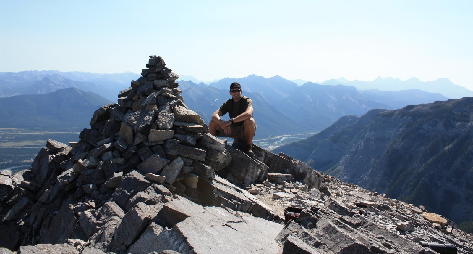
| Me on the summit with a rock cairn |
 |
| The summit register |
 |
| Rome on the summit in 2012 |
 |
| The summit ridge with the 152m cliff face to the right |
Rome's last challenge of the trip was to scree-ski down the front side of Mount Yamnuska after we were at the base of the cliff face. Scree skiing basically means a controlled run down a field of broken rock fragments. It's really quite enjoyable if you are under control and are wearing proper footwear. It also covers a lot of ground in a short period of time, so the descent is much quicker. Rome "skied" the scree like a champ and followed me all the way down the slope to the trail below. She was definitely ready for a nap when we got back home!
 |
| The trail leading down from the summit |
 |
| The front side of Yamnuska at the base of the cliff face. You can see the trail across the scree slope. We basically just dropped in at the end of the trail you can see in the picture and "skied" down to the trail below. |


.JPG)